Saturday 23 November 2013

Top of the World Highway and a town called Chicken

Leaving Kluane National Park we headed northwest towards Alaska again to the small and exciting (not) town of Tok, Alaska. As boring as Tok is, it's a good place to stock up on supplies and fill up the car before setting off for the Top of the World Highway.
Downtown chicken
A far more interesting stop is a town called Chicken that was settled by gold miners at the end of the 19th century. When a post office was established, the settlement required an official name. Since nobody could agree on the spelling of Ptarmigan, a name suggested based on the prevalence of ptarmigan in the area, they agreed upon Chicken to avoid embarrassment.

These days, Chicken is home to 17 inhabitants and downtown Chicken consists of a souvenir shop, a saloon and a cafe as well as Chicken Poop, the public bathroom. There are still some active gold mines in the area and some old dredges can be seen around Chicken.
Chicken Poop


The Top of the World Highway is one of the most northerly highways in the world and it winds its way along the crests of the hills. It's supposed to be one of the most scenic highways, but I was a bit disappointment. The scenery is beautiful and the views are spectacular but I expected snow capped mountains instead of rolling hills.


Poker Creek is the highest US road border and there is a one-hour difference in time zones at this border. The highway is mostly paved on the US side but once you cross into Canada, most of it is unpaved until you reach the vicinity of Dawson.

US-Canadian border along the Top of the World Highway

Monday 18 November 2013

The Dempster Highway

According to our rental car agreement and the waiver we signed, we were not allowed to take the rental car on the Dempster Highway, a 760km unpaved road built on permafrost that connects Dawson City to the Inuvik on the Artic Sea. However, the weather forecast was good and we couldn't resist the temptation of at least exploring part of the Dempster Highway. There is a visitor centre dedicated to the Dempster Highway in Dawson City where we got the necessary maps as well as information about the sights along the highway.


A few facts about the Dempster Highway:
- Built in 1958 for oil and gas exploration
- 761 km of unpaved road built on a gravel berm to
   insulate the permafrost in the soil underneath
- the only service station is at Eagle Plains at 370km
- Only road in Canada that leads to the Arctic Sea
- Flat tires and cracked windshields are the norm
- Named after RCMP Inspector William John Duncan
  Dempster who ran the dog sled trail from Dawson to
  Fort McPherson

A rain shower along the Dempster
The first stop along the Dempster is the Tombstone Territorial Park, part of the First Nations traditional territory. The park protects a unique wilderness of rugged peaks and permafrost landscapes with an abundance in wildlife. We did a couple of short hikes accessible from the visitors centre and the Dempster Highway and got a glimpse of the beauty of this unique landscape.

Tombstone Territorial Park
Eagle Plains (Population 8) at km 369 is the halfway point of the Dempster and also the only access to civilization along the highway. It's an important stop for food and fuel and a small hotel offers accommodations to stranded travellers. Although there is a small campground at Eagle Plains, we decided to drive to the Rock River Campground at km 440, past the Arctic Circle. In hindsight, we should have stayed at Eagle Plains as the other campground was in the woods along a river, not only was it infested by millions of mosquitos we also didn't have a view to enjoy the midnight sun on the longest day of the year. 

We made it!
The next day we decided to drive up to the border with the Northwest Territories before heading back towards civilization. The temptation to drive all the way to Inuvik was hard to resist but in the interest of time, we had to start trekking back. We also didn't want to jinx our luck by getting stuck somewhere with our rental car as we were not really prepared for this adventure in the first place. We didn't have any spare tires nor a jerry can with extra fuel but the luck was on our side this time!

The furthest North we have ever been!
Along the Dempster
The Dempster also serves as an airstrip


Friday 4 October 2013

Yukon Part 2: Kluane National Park

The scenic Haines Highway offers great views of glaciated mountains and offers a variety of scenery, from coastal forests to alpine tundra. After winding through a wide alpine valley, it descends into Haines Junction, the gateway for Kluane National Park, a UNESCO World Heritage site which includes Canada's highest peak Mount Logan (5,959m). After a visit to the visitors centre, we hiked the Sheep Creek trail that climbs along side of Sheep Mountain in the hope to see the Dall sheep. Despite the stunning view of the valleys, mountains and glaciers the only glimpse of a Dall sheep we saw through the binoculars at the visitors centre. At this time of the year, they are high up in the mountains but can be seen at lower elevations during spring and fall.

View of Kluane National Park from the Sheep Creek trail
The majority of the park can only be explored by hiking and mountaineering, however, we did explore the Alsek Valley road only accessible with a 4x4. After driving for about 10km along a bumpy road crossing several flooded areas we got to a point where the road was barely visible and we decided to track back. The scenery was absolutely stunning though.

Alsek Valley
Point of no return
Kluane National Park has been home of the Southern Tutchone for thousands of years living a nomadic lifestyle in order to take advantage of the abundances of of wildlife and plants throughout their territory. After being denied access to hunting, trapping and fishing in the 1940's the First Nations have reasserted their right to carry out their traditional activities throughout their territory with the implementation of their land claim.
The Kluskhu First Nations Village offers a glimpse into the life of a First Nations summer fish camp. This village is used by the Kluskhu First Nations to catch salmon and to dry the fish before returning to their permanent village for the winter.

Kluskhu First Nations Village


Our camp for the night was at a private campground along Lake Kluane, as the Provincial campground nearby only accepted RV's because of the bears in the area.

Cottonwood Park Campground 


Thursday 5 September 2013

Yukon - "Larger than life"


'Larger than life" is the Yukon's tourism motto and it refers to the territory's almost pristine nature. Twice the size of the United Kingdom and with only 35,000 inhabitants of which two thirds live in and around the capital Whitehorse, the territory is sparsely inhabited. In addition to the vast wilderness the Yukon is home to 14 different First Nations who make up most of the population, the famous Klondike Gold Rush, iconic drives such as the Dempster Highway and the Yukon Quest, an annual 1000-mile dogsled race from Whitehorse to Fairbanks.

We flew into Whitehorse and it was quite a difference to see the city in the summer as the first time we visited Whitehorse in February 2012, the streets were covered in snow and it was -32oC.

We started to travel along the scenic South Klondike Highway to Carcross, a First Nations settlement and home to the Carcross desert known as the world's smallest desert.

Carcross Desert
Carcross
The border between the US and Canada is bizarre, we first passed Canada Customs and then for a few miles, we were in no-mans land. The official US-Canadian border is on top of the legendary White Pass, known for the famous White Pass & Yukon Route Railroad, however, US Customs is another few miles down the road. The immigration officers are definitely more laid back than at the border crossings near Vancouver, the officer was actually friendly and had time for a chat. Our first destination was Skagway on the Alaskan Panhandle.

South Klondike Highway
US/Canadian border - South Klondike Highway
Skagway is a popular stop for cruise ships during the summer months and accordingly, the town is full of tourist shops and cruise ship passengers. However some of the old wooden buildings as well as the now touristy White Pass & Yukon Route Railroad are remnants of the area's mining past. During the Klondike gold rush, many prospectors arrived in Skagway by ship and prepared for their long journey northwards across the White Pass into the Yukon.

Skagway

Skagway is also the southern end of the South Klondike Highway and is also a gateway to the Alaska Marine Highway, Alaska's ferry system that services towns as well as remote areas along the Alaskan coast that are only accessible by sea or by air. We took the ferry to Haines, Alaska, it's an 1 1/2-hour ferry ride but by car, it's a 570km drive that would have taken us about 8 hours.
There isn't much to see in Haines and we used the occasion to stock up on groceries. During a short stop at Chilkoot Lake, we observed a grizzly bear how it turned over a little rowing boat looking for food. To his disappointment, there was nothing in the boat except for an empty plastic bag.

Heading northwards on the Haines Highway towards the Yukon, we were looking for a campground and ended up stopping at the 33 Mile Roadhouse in the middle of nowhere. The owner kindly offered us to set up camp on his land, we had all the space we wanted but we were also at the mercy of thousands of mosquitos!


Sunday 7 July 2013

25th International Congress on Adapted Sport at Mount Hood, OR

Together with 5 other VASS volunteers we embarked on a 5-day trip to Mount Hood, Oregon to attend the 25th International Congress on Adapted Sport in June. Mount Hood is a potentially active volcano in the Cascade Range and it is one of the few places in North America that offers summer skiing on one of its 12 glaciers.

While the ski area is mostly used by race teams this time of the year, we were there to broaden our skills in adaptive skiing and snowboarding. The congress was presented by the National Sports Center for the Disabled and the three instructors were extremely passionate and knowledgable. Including us 6 participants from Vancouver, there were another 18 instructors or so from various ski areas across the US and it was great sharing experiences with everyone.


Each morning we had a 5-hour on-snow clinic covering different topics and techniques followed by lunch and an hour long indoor afternoon session covering topics such as boot fitting, behaviour management, implementing safety programs and using apps to support adapted sports participants and lessons. During the on-snow sessions we covered a variety of topics including teaching exceptional lessons, Rigger Magic (how to use outriggers for three-track, four-track, mono and bi skiing), tethering techniques, visually impaired guiding, snowboarding and competition.
As a fairly new ski instructor in adaptive skiing, I learned a lot, especially the tethering clinic was a lot of new information for me. In addition, my partner during the clinic was a seasoned ski instructor and while we were playing around with the tethers, we tried different ways by giving each other feedback which was a great way to learn. The highlight of that lesson was the run I did in a bi-ski and although I was on a tether I got the hang of it pretty quickly and had a great first run.


The clinic I enjoyed the most from a personal perspective was the one on competition. The instructor teaching that clinic is the coach of the New Zealand Paralympic ski team and knows everything about racing. With my racing background as a kid, this clinic brought back some old memories and I had a great time racing through the course that we had set.


At the end of each day, the 6 of us would gather and compare notes on everything else we learned that day. The intention is to bring some of these new ideas back to Vancouver and hopefully adapt some of them in the next ski season.
A few weird facts about skiing on a volcano: smell of sulphur from the vents, volcanic ash on snow slows you down big time and is very abrasive on the skis.


Thursday 18 April 2013

Cherry blossoms

You know that spring has arrived when the cherry blossoms adorn the streets with their different shades of pink. The Vancouver Cherry Blossom Festival takes place each year in April to celebrate the 37,000 cherry trees that adorn the city. Many of these trees originate as gifts from Japan. Throughout the month the festival hosts a number of events around the cherry blossoms and there is even an up-to-date Cherry Blossom Viewing Map.


Thursday 4 April 2013

A winter with Vancouver Adaptive Snow Sports

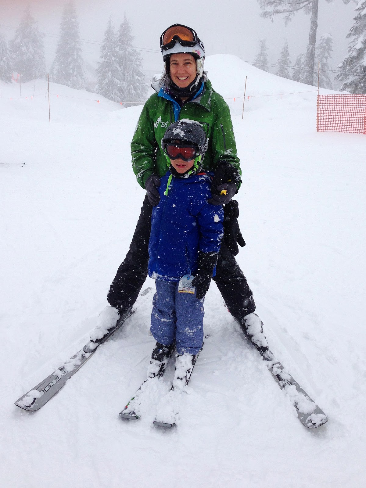
This winter I volunteered as a ski instructor for Vancouver Adaptive Snow Sports (VASS). Last December, I attended the 3-day training session on Grouse Mountain where we got familiarized with the teaching methodology as well as the use of different adaptive equipment depending on the needs and abilities of students. The sessions covered teaching visually impaired skiers, 3-track and 4-track skiers as well as sit skiers.
VASS yurt
A 4-tracker would be a student with little strength in the lower body (e.g. cerebral palsy) who uses outriggers, a sort of crutches with little skies at the bottom, hence the name 4-track. Unlike in regular skiing the turn is initiated by upper body rotation (head, shoulder and arms) and the legs just follow like the trailer of a truck.

A 3-tracker would be an amputee who uses outriggers to balance, however, the technic is pretty much the same as for a regular skier.

A visually impaired student would have little to no eye sight and teaching a visually impaired student is very hands on as we can't show them what to do. During our training session, we practiced skiing with our eyes closed and relying on a fellow instructor to give us directions. It was very awkward as one has to rely entirely on another person and the sense of moving and balance is very different.

Sit skiing is for people who have little or no mobility in their lower body. Depending on the student, a mono-ski or bi-ski can be used. The bi-ski has two skis, is lower and is easier to learn.
At the end of the training session, all of us received the Canadian Association for Disabled Skiing (CADS) level 1 instructor certification.

Adaptive equipment
My regular VASS night was on Tuesday night at Cypress with a group of experienced disabled skiers and I got assigned a regular student with a fellow instructor. My student was a young adult with cognitive and developmental issues who talked non-stop throughout the lesson. It was difficult to keep his attention to skiing especially after we met up with the rest of the group half way through the evening. Towards the end of the season he did make some progress and we had some good laughs with him.

I also did a few drop in lessons on the weekends. One student was a 6-year old autistic boy who gave me a big hug right after I met him and his mother. His mother was surprised as he usually doesn't to that. Another student was a 9-year old boy with Down Syndrome and to keep him motivated throughout the lesson we were playing Zombies.
I also got the opportunity to teach a blind Japanese student who at the end of the 2-hour lesson was able to link turns on the bunny slope. That was so inspiring!
Another student I was assisting with is a 12-year old girl a.k.a speed demon, she had to be kept on tethers as her idea of skiing is going straight down the mountain as fast as possible without turning. We were playing catch me if you can by making wide turns across the hill.


In addition to teaching skiing I have made some wonderful friends through VASS including my two ski buddies Angie, a 4-track skier and Anya, a sit-skier. We would go skiing together outside of the VASS program and have lots of fun. These two women are so inspiring as they enjoy life to it's fullest and don't let their disability get in their way.
Skiing Mount Baker
VASS also offered ski lessons for instructors and I signed up to take my CADS level 2 exam at the end of this winter season. Part of the exam was to demonstrate 3-tracking and 4-tracking which is not as easy as it sounds as it requires a lot of upper body strength. While I was in Sun Peaks at the end of March, I managed to take part in the CADS level 2 exam there and passed it. I also got my Canadian Ski Instructor Association level 1 certification earlier in March so I am all set for next year's ski season.

The experience with VASS has been very inspiring and rewarding, there are really no words to describe it.


Sunday 17 February 2013

Sunset along the Sea to Sky Highway

Driving back from Whistler to Vancouver one afternoon in January, I witnessed this wonderful sunset along the Sea to Sky Highway. Unfortunately, I was unable to capture the surreal pink and purple sky reflecting in the water over Horseshoe Bay as there are not many places to stop along the highway. These images were captured in Porteau Cove and Lions Bay.